
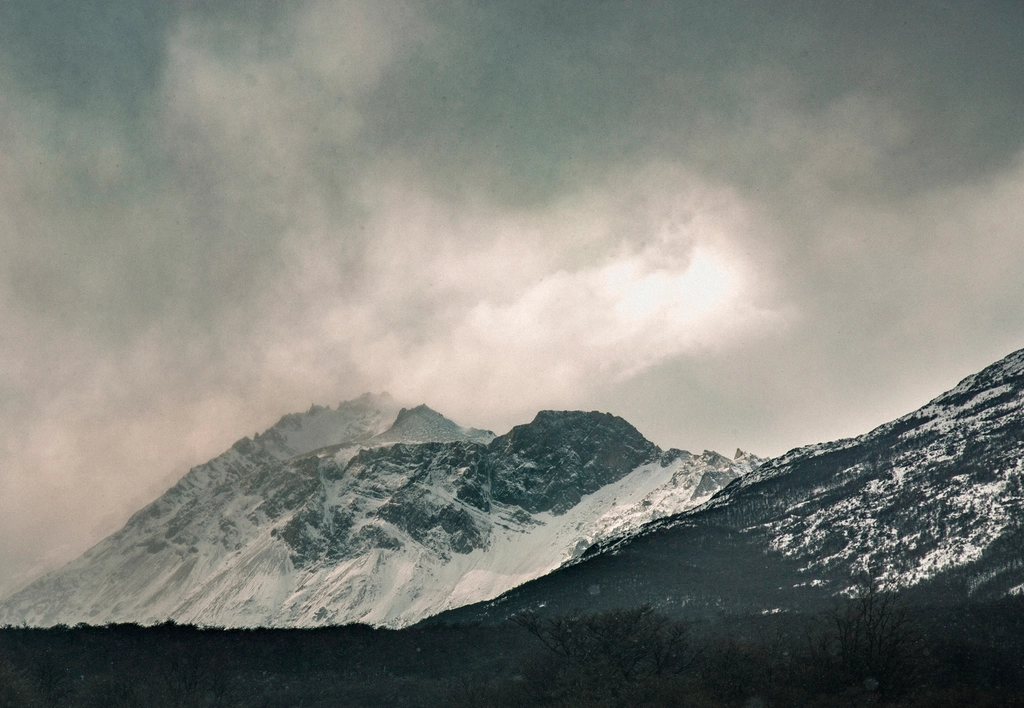
South of the Strait of Magellan the Andes make one last turn, bend east and sink into the sea. This is Tierra del Fuego, an island of beech forest, peat bog and glaciated peaks at 54 to 55 degrees south, where the mountains are lower than in the north but the weather is harder and the light is stranger. Ushuaia, on the Argentine side of the Beagle Channel, is the base for a handful of excellent day hikes; across the water, the Chilean island of Navarino holds the southernmost multi-day trek on the planet. We have spent several seasons here, and this is our guide to walking at the end of the world.
Ushuaia as a base
Ushuaia is a city of around 80,000 people squeezed between the Martial range and the Beagle Channel. It has an airport with daily flights from Buenos Aires, a full range of accommodation, outdoor shops and a maritime feel that is closer to a Norwegian port than to El Chalten. The trekking season runs from November to March, with December to February the most reliable; snow lingers on the passes into December and returns in April. Even in midsummer, daytime temperatures hover around 10 C and the wind off the channel is constant. The daylight is the compensation: in December the sun sets after 22:00 and the twilight lasts for hours.
Laguna Esmeralda: the essential half day
Laguna Esmeralda is the walk everyone does, and rightly so. The trailhead is about 18 km east of the city on the national highway, in the Tierra Mayor valley, and the route is a straightforward 4.5 km each way. It begins in lenga forest, crosses a stretch of peat bog on boardwalks and mud, passes a beaver dam and its drowned trees, and emerges at a lake of an almost artificial green, coloured by rock flour from the Ojo del Albino glacier above. The climb is modest, around 200 m, and two to three hours round trip is the norm, though the bog can be slow in wet weather and boots or gaiters are a good idea.
The beavers deserve a word. They were introduced from Canada in 1946 to start a fur trade and have since spread across the archipelago, felling beech forest and flooding valleys. The dead trees standing in water along this trail are their work, and you will see the same pattern on Navarino. There is no permit or fee; register at the trailhead if a ranger is present and start early to avoid the midday crowds from the cruise ships.
The Martial glacier and the national park
Two other walks stand out. The Martial glacier is only 7 km from the city centre; a road climbs to a base at about 500 m, and from there a trail rises through forest to a viewpoint near 1,000 m below what remains of the glacier, with the whole of the Beagle Channel and the islands of Chile spread out below. Three hours round trip from the base. Tierra del Fuego National Park, 12 km west of Ushuaia on the road that ends at Lapataia Bay, offers the Senda Costera, an 8 km coastal path through forest and along beaches, and the climb to Cerro Guanaco, a 970 m summit reached in about four hours of steady ascent with a view over the channel and the islands. The park charges an entry fee at the gate and its trails are well marked.
Dientes de Navarino: the southernmost trek
Across the channel, Isla Navarino belongs to Chile, and its small capital, Puerto Williams, is the starting point for the Dientes de Navarino circuit. The Dientes are a ring of jagged peaks a few kilometres south of the town, and the route circles them over about 53 km and four to five days, crossing four passes between 750 and 860 m. Nothing is high by Andean standards, but everything is exposed. There are no huts, no marked campsites with facilities and no shops after you leave the town. The trail is marked with numbered posts from 1 to 38, but the markers are sparse on the passes and disappear under snow, and a map, a compass or GPS and the ability to use them are essential.
The circuit starts with the climb to Cerro Bandera at 620 m, a viewpoint above the town that many people do as a day walk. From there the route traverses to Laguna del Salto, crosses Paso Australia and Paso de los Dientes on the second day with the teeth of the range close overhead, drops to a chain of lakes on the third day and then faces the crux: Paso Virginia at about 860 m, the highest point, followed by a steep descent of scree to Laguna Los Guanacos. The final day returns to the road east of Puerto Williams along beaver-dammed valleys. Peat bog, boulder fields and wind are the constants; we have had all four seasons in a single afternoon.
- Register with the police in Puerto Williams before you start and check in on return; there is no rescue service on the island beyond them.
- Carry every meal and all fuel from the town; the shops are small and gas canisters are not always available, so bring them from the mainland.
- Camp only at sheltered sites in the trees and pitch for wind; the passes are not places to stop.
- Water from the lakes and streams is drinkable, though we filter below beaver ponds.
- Do not attempt the passes in low cloud; the descent from Paso Virginia is dangerous without visibility.
Getting to Navarino
Reaching Puerto Williams is part of the adventure. From Ushuaia, small boats cross the Beagle Channel to Puerto Navarino in about an hour and a half when the weather allows, followed by 54 km of gravel road to the town; crossings are cancelled in strong wind and can leave you waiting a day or more. From Punta Arenas there is a weekly ferry through the fjords that takes about 30 hours and a short flight on small aircraft. Both frontier posts handle immigration, and the usual rules on bringing fresh food into Chile apply. Puerto Williams has basic accommodation, a supermarket and a museum on the Yaghan people, whose canoe culture lived on these channels for thousands of years.
Planning the southern end of a Patagonian trip
Tierra del Fuego rewards a slower pace than the famous parks further north. The day walks around Ushuaia fit into two or three days between flights, and the Dientes circuit needs a full week including the crossings and a weather margin. December and January are the best months for the circuit, with the least snow on Paso Virginia. Pack for cold, wet and wind at all times, bring a tent that can take a gale, and expect to spend an afternoon staring at the channel while you wait for a boat. That waiting is the price of walking further south than anyone else, and it is a fair one.