
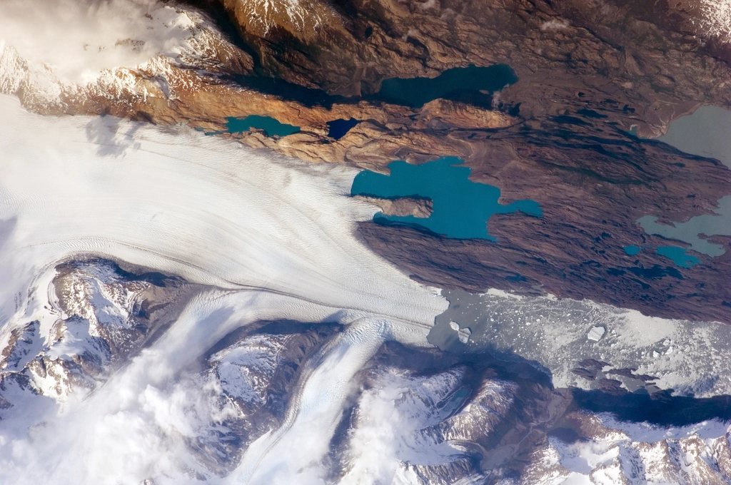
Most visitors to Torres del Paine never see the north side of the massif. The W hugs the southern lakes and the famous viewpoints, but the mountain has a back, and it is wild in a way the front no longer is: a broad valley of beech forest and bog, a lake fed by a glacier that few people can name, a river crossing on a swaying bridge, and then a pass at 1,200 m where the whole Southern Patagonian Ice Field opens beneath your boots. The O Circuit adds this back side to the W, closing the loop around the entire Paine range over roughly 120 km and seven to nine days. It is the trek we recommend to anyone with the time and a reasonable pack.
Why the circuit only goes one way
The park authority requires the O to be walked counterclockwise. You begin at the Las Torres sector on the east, walk north around the massif, cross John Gardner Pass from east to west, descend to Glacier Grey and finish along the W. There are two reasons. The pass is steep and loose on its western side, and it is far safer to descend it than to climb it with a full pack; and a single direction means every campsite on the back side receives a manageable flow of people, since the trail between Seron and Grey has a daily quota.
The back side is open for a shorter season than the W. The section between Seron and Paso is normally accessible from November to the end of March; outside those months the campsites close and rangers do not allow anyone onto the pass. Even in season the pass can be shut for a day when the wind is too strong or fresh snow covers the cairns.
The stages, in order
The first three days are gentle and are best treated as an approach. From the Central sector the trail heads north through grassland and old fire scars to Seron, about 13 km and 4 hours away, then climbs a windy shoulder above the Paine river and drops to Dickson, 18 km and 6 hours from Seron, on the shore of Lago Dickson beneath a wall of blue ice. The third stage to Los Perros is short, about 12 km and 4 hours, through dense forest to a glacier-fed lagoon full of small icebergs, and this is where the mood changes. Los Perros is cold, damp and thick with mosquitoes in January, and everyone goes to bed early because of what comes next.
The pass day is the reason to do the O. From Los Perros the trail climbs about 600 m through mud and bog, then over rock and scree to John Gardner Pass at roughly 1,200 m. On the far side the ground falls away and Glacier Grey fills the view, more than 6 km wide at its front and stretching north into the ice field until it blurs into cloud. The descent to Paso campsite is steep, with ladders and roots, and from Paso the trail continues along the flank of the glacier past three suspension bridges to Refugio Grey. Los Perros to Grey is about 22 km and 10 to 12 hours; many people break it at Paso if they can secure the reservation.
From Grey you are on the W. The remaining stages, Paine Grande, the Frances valley, Los Cuernos and the climb to the towers, are described in our W guide, and they feel like a reward after the pass. Total distance depends on which viewpoints you add, but 115 to 130 km over eight days is typical.
Rules on the pass day
Rangers at Los Perros enforce a departure window. You must set off early in the morning, usually before 07:00, and nobody is allowed to start the pass after a fixed cut-off, so that everyone reaches Paso or Grey in daylight. If the ranger closes the pass because of weather, you wait at Los Perros, and this is why a spare day matters more on the O than on the W. There is no mobile signal on the back side and no way to change bookings once you are in.
- Reservations are compulsory for every night; the back side campsites are small and sell out early for December to February.
- Check the park’s daily quota for the Seron to Grey section when you book; it is applied when you enter the circuit at Seron.
- Camping is only permitted in the designated sites, and cooking only in the shelters provided.
- Carry your rubbish out; there is no collection on the back side.
What is different from the W
Self-sufficiency. The back side has campsites with basic shelters and, at Dickson and Grey, a refugio with meals, but for at least four days you should assume you are carrying your own food and stove. Packs of 14 to 18 kg are normal at the start. Weather is another difference. The north side faces the ice field directly, and rain, sleet and wind arrive with less warning than on the lakes. Mud is constant between Dickson and Los Perros, and gaiters earn their weight.
The reward is solitude. On the W you share viewpoints with hundreds of people on a good day. Between Seron and the pass we have gone hours without seeing anyone, watched condors work the thermals above Dickson and heard the glacier calve into the lake at night. The perspective from John Gardner Pass is unlike anything on the front side: not a single glacier tongue but an ice field, the third largest expanse of ice outside the poles, ending at your feet.
Timing and logistics
January and February have the most reliable pass conditions and the longest days, with light until 22:00. December can still hold snow on the northern side of the pass. March is quieter and colder, and the beech forest turns red in the last two weeks, but the back side closes at the end of the month and late bookings are risky. We plan nine days on the ground: seven for walking, one spare for the pass, one for the bus and catamaran connections.
Access is the same as for the W. Buses from Puerto Natales reach the Laguna Amarga entrance in about two and a half hours, and a shuttle continues to the Central sector where the circuit begins. Entry tickets are bought online before arrival and checked with your reservations. Gas canisters, dehydrated food and maps are all available in Puerto Natales.
Is the O for you
If you have walked multi-day trails with a full pack and are comfortable with a ten-hour day on rough ground, the O is not technically difficult. What it demands is planning: bookings months ahead across more than one system, a fixed direction, a fixed order of campsites and a weather margin. Meet those conditions and you get the complete mountain, the ice field from above and a week that makes the famous towers feel like the final paragraph of a much bigger story.