
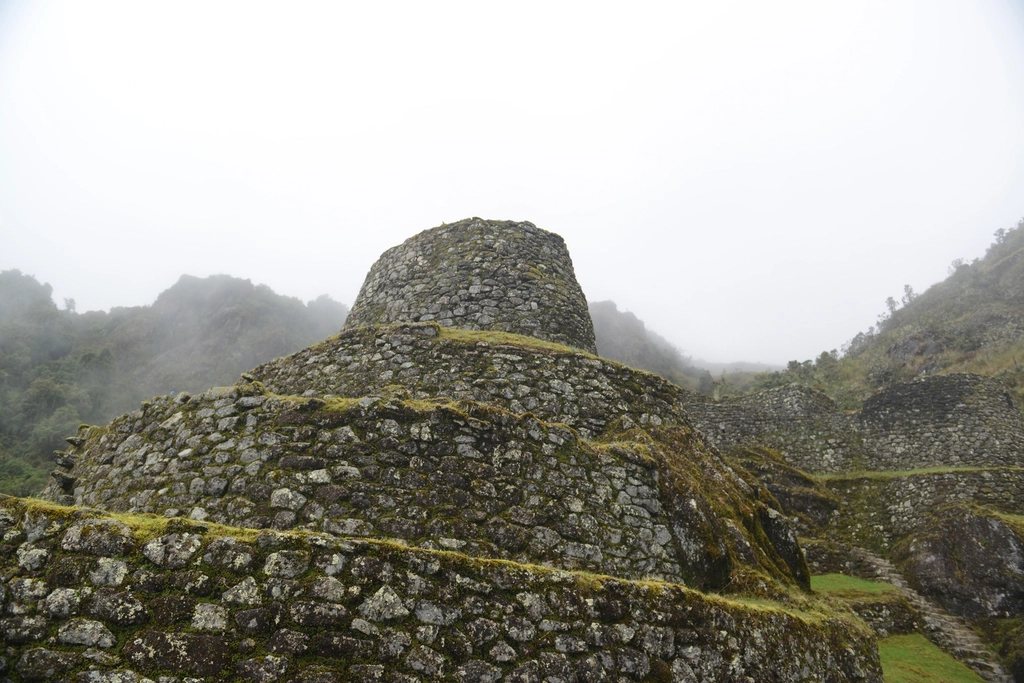
Choquequirao means “cradle of gold” in Quechua, and it is the Inca city most travellers have heard of and almost none have seen. It sits at 3,050 m on a ridge above the Apurimac canyon, north-west of Cusco, larger than Machu Picchu in surface area and perhaps a third excavated. There is no train, no road and no gate. The only way in is a 60 km round trip on foot that drops 1,500 m into one of the deepest canyons in the Andes and climbs straight back out, twice. That walk is the reason the ruins receive dozens of visitors a day rather than thousands.
The shape of the trek
The standard itinerary takes four days from the road head at Capuliyoc, a viewpoint at about 2,900 m reached by a short drive from the village of Cachora, itself four hours by road from Cusco. Day one descends 1,350 m on a relentless zigzag trail through cactus and dry scrub to the Apurimac river at Playa Rosalina, 1,550 m, with a camp either at Chiquisca (1,900 m) on the way down or at Santa Rosa (2,100 m) after the bridge. Day two climbs 1,300 m to the terraces of Marampata at 2,900 m and continues to the archaeological site, 3 km further along the ridge. Day three is the site, then the return to Chiquisca. Day four climbs back to Capuliyoc. Total ascent and descent over the four days is close to 3,000 m each way, which is why we call this a strenuous trek despite its modest maximum altitude.
Heat, not altitude, is the enemy
Unlike most walks in the Cusco region, Choquequirao is not primarily a high-altitude problem. The trail never exceeds 3,100 m and most people who have slept in Cusco for two nights first will be comfortable. The canyon floor is another matter. At 1,500 m the Apurimac gorge is hot and dry, with midday temperatures above 30 degrees and almost no shade on the climbs. Sandflies at the river camps bite hard and leave itchy welts that last days. We start each climbing day before first light, carry at least three litres of water, cover arms and legs and rest in the shade of the few settlements rather than in the open. Water sources exist on both sides of the canyon but are spaced several hours apart on the ascents, and every one of them should be filtered or treated.
What you actually see
Choquequirao is spread across a hilltop and several terraced flanks. The main plaza, the ceremonial platform on the levelled summit, the two-storey buildings and the water channels are impressive in their own right. What sets the site apart are the terraces on the western slope, where white stones set into the walls form a procession of llamas, one of the most original pieces of Inca decorative work anywhere. Below the plaza, a second staircase of terraces drops hundreds of metres towards the river and gives a sense of how much agriculture the city supported. Because so little has been cleared, the forest still holds the outer sectors, and walking between them along overgrown paths is a rare taste of what these sites were like a century ago. Allow a full day; half a day is not enough for the llama terraces and the upper platform together.
Beyond the ruins: on to Machu Picchu
For those with eight or nine days, Choquequirao is the first act of one of the finest long treks in Peru. From the ruins a trail climbs the Yanama valley, crosses a pass at about 4,670 m, descends past the smaller ruins of Pinchaunuyoc and continues by way of the villages of Yanama and Totora to the cloud forest of the Santa Teresa valley. From there the route joins the lower Salkantay trail to the hydroelectric station and the railway walk to Aguas Calientes. The full traverse is around 115 km with a real high pass, hot canyons and a cold camp near 4,000 m. It requires acclimatisation for the second half, food for a week and a good deal of stamina, and it is one of the few ways to reach Machu Picchu that still feels like an expedition.
Seasons, fees and logistics
The trail is open all year. The dry season from May to September gives the most reliable footing on the steep descents and clear views of the snow peaks across the canyon. April and October are pleasant and quieter. The wet months from December to March bring slippery mud, swollen streams and low cloud over the ruins, and the heat in the canyon becomes humid rather than dry. An entrance fee is collected at a checkpoint before Marampata, payable in cash. Simple campsites with water, basic toilets and small shops selling drinks and snacks exist at Chiquisca, Santa Rosa and Marampata, and mules with their handlers can be hired in Cachora or Capuliyoc for anyone who would rather not carry a full pack up 1,300 m of switchbacks in the heat.
- Four days minimum; five if you want a full day at the site without a dawn departure.
- Three litres of water capacity per person and a filter or tablets.
- Long sleeves, a wide hat and insect repellent for the canyon camps.
- Trekking poles: the descents are long and hard on the knees.
- Cash for the entrance fee, campsites and mule hire.
A cable car across the canyon has been proposed and shelved repeatedly for more than a decade. If it is ever built, Choquequirao will change overnight. For now the city belongs to those willing to walk down into the heat and back up again, and to share the plaza at sunset with a handful of other people and a great many hummingbirds.