
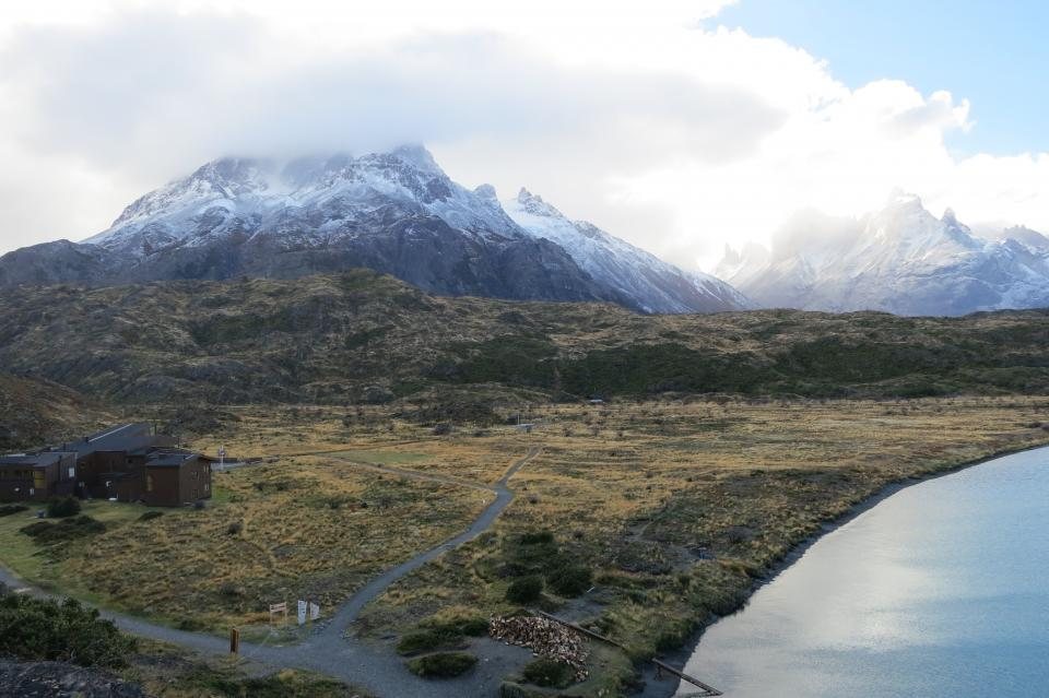
Southern Patagonia is one of the most remote trekking regions on earth by distance, and one of the easiest to reach by logistics, provided you understand its shape. There are two gateways, one Chilean and one Argentine, separated by a border that is quick to cross and easy to get wrong. Nearly every trip to Torres del Paine, El Chalten or the Perito Moreno glacier begins with a choice between them, so we start there.
The two gateways
Punta Arenas, on the Strait of Magellan at 53 degrees south, is the Chilean gateway. Flights from Santiago take about three and a half hours and cover almost 3,000 km; the airport sits 20 km north of town on the road to Puerto Natales. Punta Arenas itself is a working port with a fine cemetery, a windy waterfront and good supermarkets for a final resupply, but for trekkers it is mainly a place to pass through on the way to Puerto Natales, 250 km and three hours north by bus, which is the true base for Torres del Paine.
El Calafate, on the south shore of Lago Argentino, is the Argentine gateway. It has direct flights from Buenos Aires of just over three hours, and from there it is 80 km by road to the Perito Moreno glacier and 215 km, about three hours by bus, north to El Chalten and the Fitz Roy trails. If your trip is mainly about Fitz Roy and Cerro Torre, fly into El Calafate. If it is mainly about the Paine massif, fly into Punta Arenas. If it is both, fly into one and out of the other; the open-jaw itinerary costs little more and saves a full day of backtracking.
Reaching the gateways from the capitals
Santiago’s airport handles domestic and international flights in the same complex, so a connection from Europe or North America to Punta Arenas can be done on a single ticket with a couple of hours between flights. Buenos Aires is more awkward: most long-haul flights land at Ezeiza, 35 km southwest of the centre, while most flights to El Calafate leave from Aeroparque on the city’s riverfront. Allow three hours for the transfer across the city, more on a weekday afternoon, and consider a night in the capital if your arrival is late. There is no practical rail link to either gateway; by road, Buenos Aires to El Calafate is about 2,700 km and two full days on a bus, which is a fine adventure and a poor use of holiday time.
A slower and very beautiful alternative on the Chilean side is the cargo-passenger ferry that sails weekly from Puerto Montt through the fjords to Puerto Natales, taking three to four days. It is not a cruise; cabins are basic, the sea across the Golfo de Penas can be rough, and sailings shift with the weather. It is, however, the only way to see the inside passage of the Chilean coast without a private boat.
Puerto Natales, El Chalten and the last legs
Puerto Natales is small, walkable and set up entirely for the park: gear hire, supermarkets, camping gas, and the bus terminal from which several departures a day run the 110 km to the Laguna Amarga entrance of Torres del Paine in about two hours. Park entry has to be bought online in advance, and refugio and campsite reservations are handled by the park authority and two concession holders, all of them with separate booking systems that open months ahead of the summer season. From Laguna Amarga a shuttle takes you the last stretch to the start of the W, or you can continue on the same bus to the catamaran across Lago Pehoe for the western end.
El Chalten is smaller still and has no bank of any use, so bring cash. Its great virtue is that the trails to Laguna de los Tres and Laguna Torre start on the edge of the village: no bus, no permit, no fee. The road from El Calafate crosses the empty steppe along Lago Viedma, and the bus timetable is generous in summer, thin in the shoulder months, and almost absent from May to September.
Crossing the border
The link between the two gateways is the road from Puerto Natales to El Calafate, about 300 km and five to six hours by bus including the two border posts. Buses cross at Paso Rio Don Guillermo, near the Chilean hamlet of Cerro Castillo, or further south at Paso Dorotea by the coal town of Rio Turbio. Both are straightforward: everyone gets off, queues at the exit window of one country and the entry window of the other, and reboards.
The trap is food. Chile enforces strict agricultural controls and inspects luggage on entry. Fresh fruit, vegetables, honey, seeds, unprocessed meat and dairy are all confiscated and, if undeclared, fined. Declare everything, eat your apples on the Argentine side, and keep trail food to sealed, processed items. Argentina has no equivalent inspection. Note too that the crossing near Cerro Castillo is a short distance from the Torres del Paine road, so it is possible to travel from El Calafate directly to the park in a day with an early start.
Tierra del Fuego and the far south
Ushuaia, at 55 degrees south, has its own airport with direct flights from Buenos Aires of about three and a half hours, and it connects to Punta Arenas by a bus journey of roughly twelve hours. That route crosses the Strait of Magellan on a vehicle ferry at Primera Angostura, a 20-minute passage that is sometimes suspended in high winds, and passes the border at San Sebastian. It is a long day but a memorable one, with guanacos and the occasional rhea on the steppe. For the Dientes de Navarino circuit, the Chilean village of Puerto Williams across the Beagle Channel is reached by small plane from Punta Arenas or by boat from Ushuaia.
Practical details worth knowing before you land
- Currency: Chile uses the Chilean peso and cards work almost everywhere in Punta Arenas and Puerto Natales. Argentina uses the Argentine peso, and cash, in pesos or US dollars, still matters in El Chalten.
- Time: Chile’s Magallanes region keeps the same clock all year, which puts it in step with Argentina and one hour ahead of Santiago during the Chilean winter.
- Fuel: canister gas is sold in both Puerto Natales and El Chalten but cannot be flown; buy it on arrival.
- Wind: flights into Punta Arenas and El Calafate are occasionally delayed by gales. Do not plan a park reservation for the same day you land.
- Seasonal services: from May to September bus frequencies fall sharply, some routes stop, and the ferry across the strait runs to a reduced schedule.
Get the gateway right, respect the border on food, and the rest of the journey takes care of itself. The hard part of Patagonia is not getting there; it is deciding when to leave.