
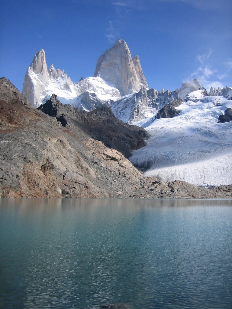
Cerro Torre is the other mountain of El Chalten, and for many of us it is the more haunting one. Fitz Roy is a fortress; Cerro Torre is a needle, 3,128 m of vertical granite capped with a mushroom of rime ice that has defeated climbers for a century. You cannot walk up it, but you can walk to its feet in a morning. The trail to Laguna Torre is the gentlest of the great day hikes in the northern sector of Los Glaciares National Park, and it ends at a lake of icebergs with the spire standing directly above. This is how to do it, and how to extend it if the weather holds.
A short history of a difficult mountain
The peak is famous partly for what is not known about it. A claimed first ascent in 1959 ended with the death of one of the two climbers and was never verified, and the debate about it defined the mountain for decades. In 1970 an expedition drilled a ladder of bolts up the south-east ridge with a petrol-powered compressor, a route that was later stripped of most of its bolts in 2012 amid another controversy. The first undisputed ascent came in 1974 on the west face. None of this matters to a walker except as an explanation for the atmosphere: at the lake, with the tower above, you understand why people have argued about it for so long.
The trail, step by step
The Laguna Torre trail starts on the western edge of the village, a few streets from the main road, and heads west up the Rio Fitz Roy valley. The first kilometre climbs gently through lenga forest and scrub to a small rise, then the path settles into the wide valley floor. At about 3.5 km a marked spur on the right leads to Mirador Cerro Torre, a viewpoint on a low ridge where the full massif appears for the first time: the tower itself, and to its right the smaller spires of Egger and Standhardt. This is the point to turn around if the cloud is down, because the view from the lake is the same skyline seen from lower down.
From the viewpoint the trail descends briefly and follows the river on flat ground, sometimes through forest and sometimes across open gravel with the peaks ahead. At about 8 km you reach De Agostini campsite in the trees, and a few hundred metres later the path climbs the terminal moraine and Laguna Torre is below you. The distance is about 9 km one way with roughly 250 m of total ascent, the lake sits at around 700 m, and three hours each way is a comfortable pace. Round trip, with a long stop, is a six to seven hour day.
The lake and Mirador Maestri
Laguna Torre is grey rather than blue, coloured by rock flour, and it is usually dotted with icebergs calved from Glaciar Grande, which ends in the water at the far side. The wind funnels down the valley and makes the moraine crest a cold place to sit; drop a few metres to the shore for shelter. When the tower is clear, the view is one of the great sights of Patagonia: a single granite blade with the ice mushroom on top, the glacier tumbling below, and the Egger and Standhardt needles beside it.
The trail does not end at the lake. A path continues along the crest of the northern moraine for about 2 km to Mirador Maestri, climbing 150 m over loose stone with the lake on one side and steep scree on the other. It is exposed and takes about an hour, but it brings you level with the glacier front and much closer to the spires; on a still day you can hear ice breaking off the seracs. Do not attempt it in strong wind. The moraine is narrow in places and the gusts here are stronger than in the valley.
Combining Laguna Torre with Fitz Roy
The two classic trails are linked by an 11 km connector past Laguna Madre and Laguna Hija, two quiet lakes on the plateau between the valleys. From De Agostini campsite the connector climbs north through forest and bog to the lakes, then meets the Laguna de los Tres trail near Laguna Capri or Poincenot. Walking all of it in a single day, town to Laguna Torre, over to Laguna de los Tres and down to town, is about 26 km with the steep final climb to the Fitz Roy lake near the end, and it is a serious 10 to 12 hour effort. The kinder version is a two-night loop: camp at De Agostini, cross to Poincenot, climb to Laguna de los Tres at sunrise on the second morning and walk out.
- Both campsites are free, have no shop or shelter beyond a cooking area, and fill up in January.
- Register at the park visitor centre before camping and follow the no-fire rule; the forest here has burned before.
- Water is drinkable from the streams; carry a filter only if you prefer.
- Leave the tent early. The morning is calmer and the peaks are more often visible before 11:00.
Season, weather and what to carry
The trail is walkable from October to April and is often the last one to close when snow arrives, since it stays low and mostly in the valley. It is also the best choice for a windy or partly cloudy day, because the walk itself is pleasant even when the tower stays hidden. Cerro Torre is hidden more often than Fitz Roy; it catches the moisture rolling off the ice field and the ice mushroom on its summit is the result. We have walked to the lake four times and seen the full spire twice.
The path is well marked and busy, so navigation is not a concern. Footwear with grip matters on the moraine and on the connector, which is muddy in places. Carry a shell, a warm layer for the lake, food and a litre of water. Trekking poles help on the moraine to Mirador Maestri.
Why this walk stays with you
Laguna de los Tres gives you the drama of a steep climb and a sunrise. Laguna Torre gives you something quieter: a long, easy approach through the forest, the sound of the river, and then a lake of ice below the most improbable mountain in the Andes. It is the walk we do on our first morning in El Chalten to loosen our legs, and the one we do again on the last day if the sky finally clears.