
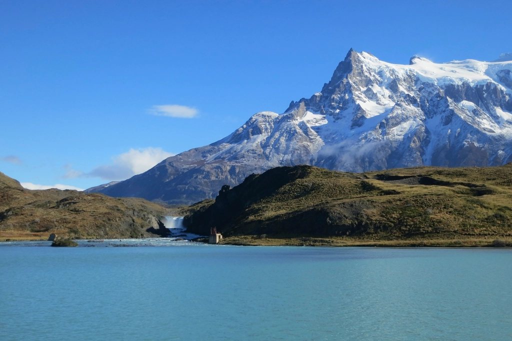
The W is the trek most of us picture when we think of Chilean Patagonia: three granite towers glowing at dawn, a glacier calving into a grey lake, a valley walled in by hanging ice. It earns its name from the shape it traces on the map, three prongs pushing north into the Paine massif, linked by a long traverse along the lakes. Over roughly 75 km and four to five days, it strings together the three great viewpoints of the park without the harder logistics of the full circuit. We have walked it in both directions and in three different months, and this is what we wish we had known the first time.
The shape of the route
The W runs between two anchor points on the southern edge of the massif. On the west is Paine Grande, on the shore of Lago Pehoe, reached by catamaran from the Pudeto jetty. On the east is the Las Torres sector at the mouth of the Ascencio valley, reached by road from the Laguna Amarga entrance. Between them lie the three prongs: the Grey valley to the west, the Frances valley in the middle and the Ascencio valley to the east, where the towers stand.
Most people walk west to east, which saves the towers for the last morning. The classic five-day version looks like this: day one from Paine Grande north to Refugio Grey and back, or a night at Grey; day two back to Paine Grande and on to the Italiano or Frances campsites; day three up the Frances valley to the Britanico viewpoint and down to Los Cuernos; day four along Lago Nordenskjold to Chileno; day five up to the Base de las Torres viewpoint at first light and out to the park entrance. Walking east to west simply reverses the order and puts the towers on day one, which is a fine choice if your reservation dates force it.
Distances and what each day feels like
None of the individual stages is long by Andean standards, but the terrain is rarely flat and the wind adds an invisible tax on every kilometre.
- Paine Grande to Refugio Grey: about 11 km, 3.5 to 4 hours, with a first view of Glacier Grey from a windy ridge about halfway.
- Paine Grande to Italiano campsite: about 7.5 km and 2.5 hours along the shore of Lago Skottsberg.
- Italiano to the Britanico viewpoint: about 5.5 km each way with 500 m of climbing, 5 to 6 hours round trip, packs left at the ranger post.
- Italiano to Los Cuernos: about 5.5 km and 2 hours on rolling trail above Lago Nordenskjold.
- Los Cuernos to Chileno: about 12 km and 5 hours, including the shortcut that avoids descending to the Central sector.
- Chileno to the towers viewpoint: about 4 km and 2 hours, the last 45 minutes a steep scramble over moraine boulders.
The viewpoint at the base of the towers sits at roughly 870 m, below three granite spires that top out near 2,500 m. The Frances valley is the quieter highlight: the trail climbs past the hanging glaciers of Paine Grande, whose summit at 2,884 m is the highest in the massif, and the ice groans and avalanches off its flanks all day long.
Refugios, campsites and the reservation puzzle
Here is the single most important thing to understand: you cannot walk the W without a confirmed reservation for every night, and rangers check them at the entrance and at each sector. Free camping outside the designated sites is forbidden and enforced. The accommodation is split between the park authority and two private concessions, each running its own booking website, and a five-night itinerary usually requires bookings on more than one system. For January and February, the busiest months, the popular sites sell out four to six months ahead. Booking in August for a February walk is normal; booking in December is often too late.
Each refugio offers dormitory beds, hot meals and a shop, and each has an adjacent campsite where you can pitch your own tent or rent a pre-pitched one with a sleeping bag and mat. Full board removes the need to carry a stove and food, which is the main reason a five-day W with a light pack is realistic for fit beginners. Cooking is only allowed in the designated shelters; open fires have caused two major park fires in the past twenty years and are treated with zero tolerance.
The wind, and why it decides your day
Patagonian wind is not a breeze that picks up in the afternoon. It is a permanent feature of the landscape that can reach 100 km/h on exposed ridges, pin you to the ground on the moraine below the towers, and lift spray from Lago Nordenskjold into your face a kilometre from the shore. Trekking poles are not optional, pack covers are useless in the gusts, and tents need every guy line staked with rocks.
The practical rule is simple: start early. Mornings are usually calmer, and the viewpoints are best before the cloud builds over the massif around midday. The towers in particular are a sunrise objective. From Chileno the walk takes two hours, so headlamps come on at four in the morning in midsummer, and the granite turns orange for about ten minutes if the sky is clear.
When to go
The trekking season runs from October to April. December to February brings the longest days, with light until 22:00, and the largest crowds. November and March are our favourite months: fewer people, shorter queues at the catamaran, and autumn colour in the lenga beech forests from mid-March. Snow can fall in any month, and the towers viewpoint is sometimes closed for a day or two in October and April.
The park entrance fee is paid online in advance, and the ticket is checked together with your reservations. Puerto Natales, about two and a half hours by bus from the Laguna Amarga entrance, is the base town for supplies, gas canisters and last-minute gear. Buses leave early in the morning and connect with the catamaran across Lago Pehoe, which runs a few times a day in season.
Packing for five days
Layering matters more than anything else. A typical day can start at 2 C at the Chileno campsite and reach 20 C in the Frances valley by early afternoon, then drop into horizontal rain. We carry a shell jacket and shell trousers, a warm mid-layer, a light down jacket for the viewpoints and the evenings, and gloves and a hat even in January. Water is safe to drink from the streams above the campsites, and a one-litre bottle is enough since refills are frequent.
Finally, keep a spare day in your plans on either side of the trek. The wind closes the catamaran on some afternoons, buses fill up, and a storm can take the towers out of view for 48 hours. A clear morning at the base of the towers is worth every hour of planning.